Anti-colonial TTRPG Map
This blogpost is part of the maps blogwagon, initiated by Prismatic Wasteland.
My most popular blogpost is the Bloggies nominated Anti-colonial Dungeon, inspired by the likes of Zedeck Siew's Decolonising D&D and Habeeb's the default dungeon is colonial.
Now, I shall try to come up with a gameable Anti-colonial TTRPG Map, at least from an Indonesian perspective. One needs to understand that modern maps are useful creation of the Western culture. But the historical context is that they are made as a tool for colonialism.
Markus of Personal blog also brought this up in his map blogwagon post, how the methods behind mapping were developed largely in conjunction with the European colonial project to maintain overseas empires.
Historically, maps have been used as powerful tools of colonization to reinforce Western worldviews, territorial claims, and perspectives that marginalize Natives cultures and views. That is why colonial Eurocentric maps often omit or misrepresent Natives territories, place names, and landmarks.
So if you want to make an anti-colonial setting/adventure/game from the perspective of the oppressed Natives, you should create an Anti-colonial TTRPG map. It would certainly show a different perspective on how the Natives see their colonized region.
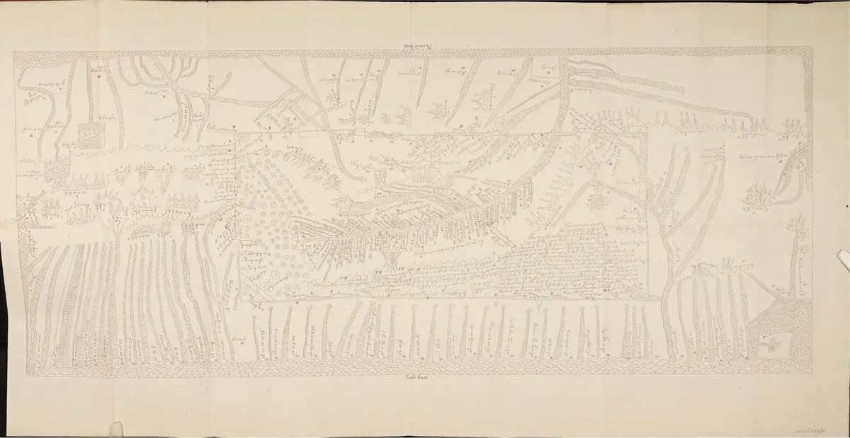 The Ciela Map, a surviving pre-colonial map of the western part of Java.
Let's take a look at The Ciela Map, created around the 16th century to map out the western part of Java (now Jakarta, West Java, and Banten). The words on the map are written in Old Sundanese (except for the alphabet scripts and numbers, added later for research). It shows borders (simple ones), cultural landmarks (e.g. settlements), and geographical landmarks (fields, rivers, seas, mountains, forests, etc). Basically stuff that might also shown in European colonial maps and modern maps. But the way it is presented is different. There are no detailed borders, no colorization to differentiate certain areas. The center of the map is the city of Pajajaran and the heartlands of the Sunda Kingdom.
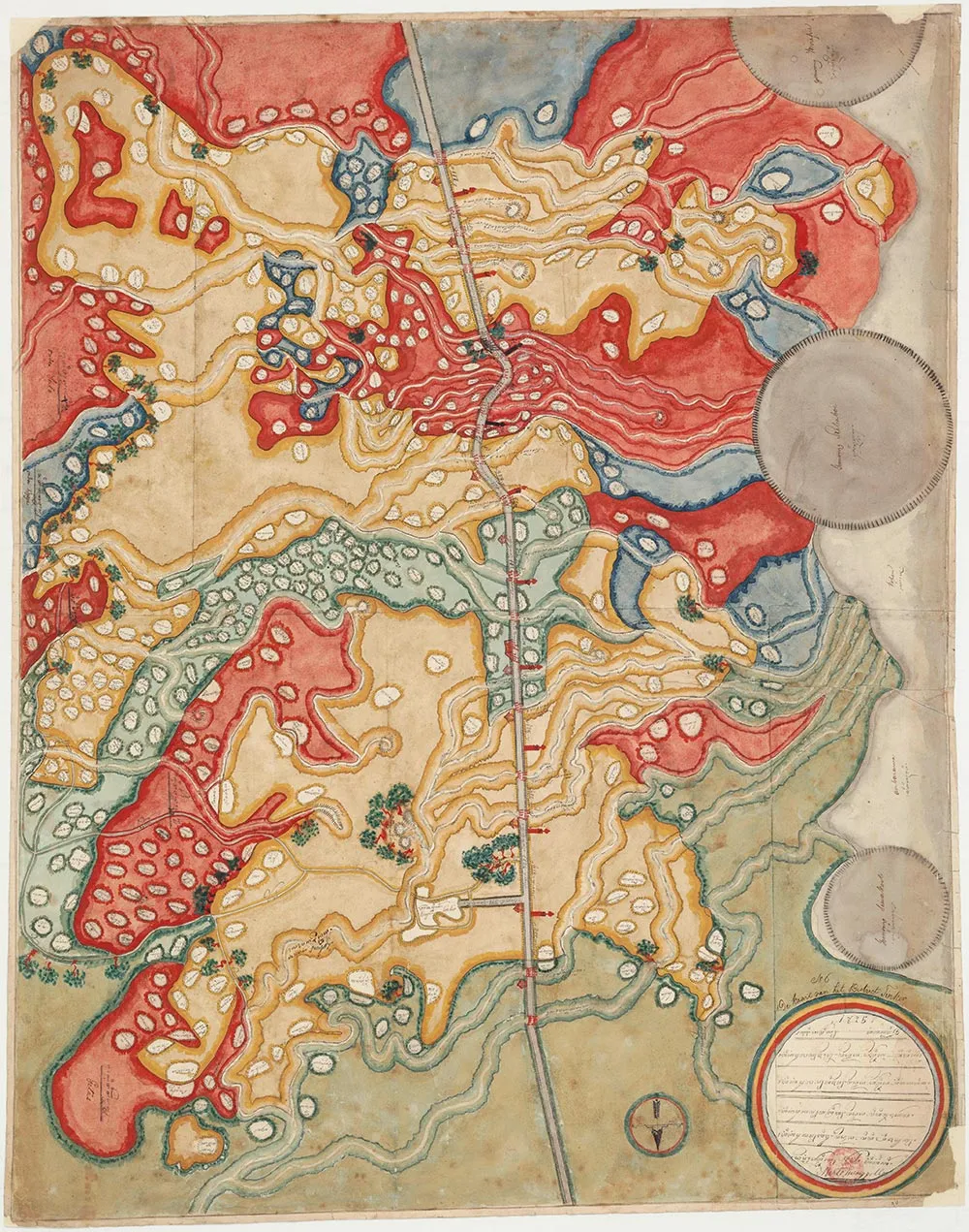 19th century map of the district of Tingkir, in a mix of European colonial and native Javanese style.
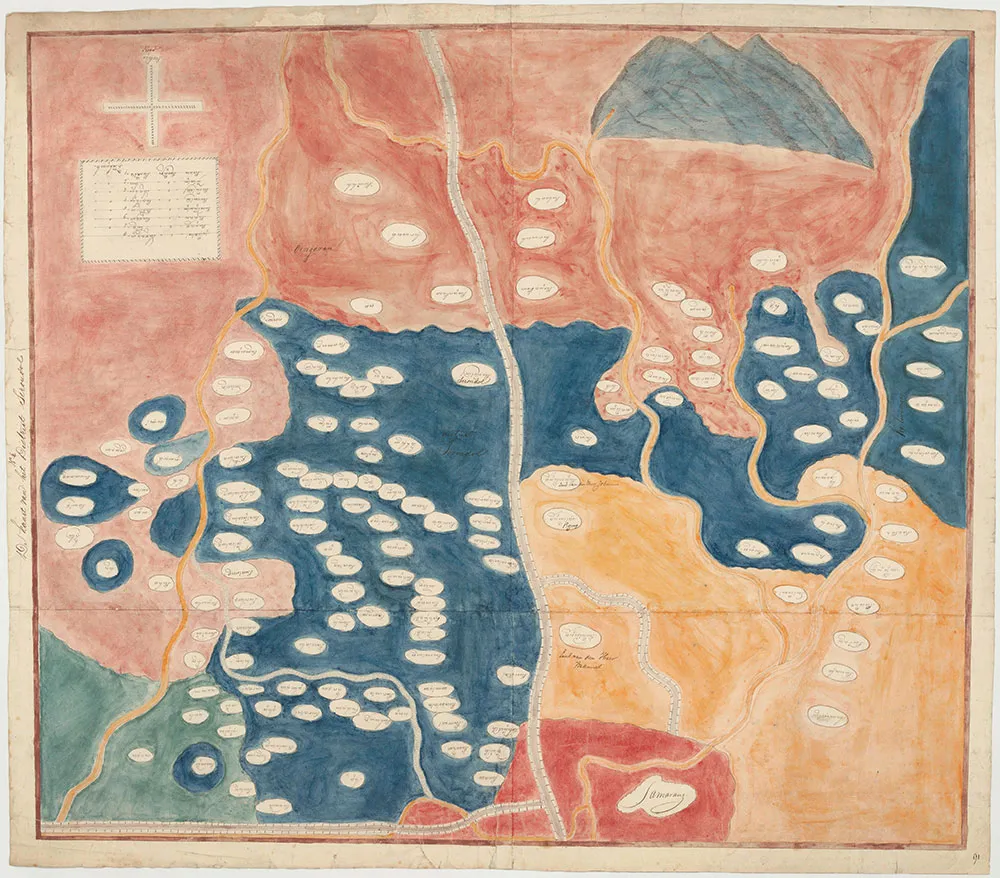 19th century map of the district of Srondhol, in a mix of European colonial and native Javanese style.
The other two examples, maps of the districts Tingkir and Srondhol, are already influenced by European colonial style (especially the colorization and differentiate of certain areas), with most elements of the native style remaining (borders, roads, landmarks, etc). You can also see that orientation doesn't really matter. Other native maps from outside of Indonesia don't really conform to the European colonial or modern "north is up" perspective.
So if I want to make an Anti-colonial TTRPG Map, these are the things I will keep in mind:
- It should tell a narrative, based on the memory of the native residents. Not measured geometry.
- The map orientation should be fluid, it needs to have meaning instead of just north being up.
- Landmark-focused. Putting emphasis on both geographical and cultural landmarks.
- Using symbolic icons instead of literal drawings of the landmarks.
- There should be a meaningful center of the map, but not just the capital city. The natives believe that their homeland is the center of the world, of their lives.
- No clear borders. Territories will overlap and blur. Not fixed like in modern/colonial maps.
Maps have long served as tools for asserting colonial authority and claiming control over land. Therefore by contrast, an Anti-colonial TTRPG Map should center Native sovereignty, questioning imposed borders and reflecting the deeper, more complex relationships people have with land.
Honestly, I haven't tried the pointers I've mentioned above. I am still developing the groundwork for Oddipelago. Once that's done, I will make an Anti-colonial TTRPG map for Oddipelago and make a new blogpost.
Sources and References:
- https://personable.blog/the-map-speaks/
- https://telusuri.id/menggali-kisah-dari-manuskrip-peta-untuk-wisata-arkeologi-sejarah/
- https://validnews.id/kultura/Peta-Ciella--Satu-satunya-Peninggalan-Karya-Bumiputera-QWA
- https://www.iias.asia/the-newsletter/article/javanese-maps-1825-story-politics-art-and-scholarship *https://scholarblogs.emory.edu/postcolonialstudies/2014/06/21/maps-in-colonialism/
- https://nitep.educ.ubc.ca/january-08-2024-decolonizing-maps-addresses-the-biases-inaccuracies-and-colonial-perspectives-inherent-in-many-cartographic-representations/
- https://hyperallergic.com/how-cartography-helped-make-colonial-empires/